Georeferencer
If you use old maps you might want to try our Georeferencer tool.
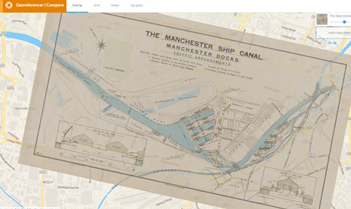
Georeferencer lets you place historic maps over current maps so you can compare the past with the present.
The Georeferencer tool can be used to view our digitised maps side by side or as overlays on current mapping.
This has many advantages such as:
- Helping us to visualise how a landscape has changed over time
- Helping us to identify historical or unfamiliar locations
- Helping us to match and compare changing place names
Most of the maps we have Georeferenced so far include maps of Manchester and the surrounding area but we will be adding more maps gradually.
Explore Georeferencer
- You can search the maps we have Georeferenced already by scrolling through recently Georeferenced maps.
- Alternatively, you can navigate directly to Georeferencer Compare and select a map from the list.
Georeferencer
To explore further, visit The University of Manchester Georeferencer pages.
Read more
Compare maps
Explore Georeferencer comparisons that have we have already created.
Read more
Accessibility
Find out more about the online accessibility of the Georeferencer platform.
Read more